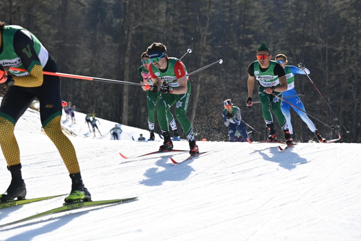
New Hampshire has had one of its warmest winters on record, but thanks to recent improvements at the Oak Hill Outdoor Center, Dartmouth’s Nordic ski team was able to practice all season at home.
Located off Lyme Road just 2.1 miles from downtown Hanover, Oak Hill features an extensive trail network with four new race loops for cross country skiing with snowmaking operations.
“At this time of year, if there isn’t a lot of snow, it’s hard for the team to stay motivated if they have to drive an hour and a half to practice in good snow,” says Callie Young ’22, assistant Nordic coach and former Dartmouth Nordic skier. “But this year, our team was pumped to have been able to get out there every single day.”
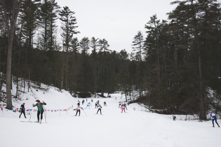
Oak Hill also hosted Winter Carnival races this year, something that would not normally be possible in such a warm year. Previously, a backup site, such as the Craftsbury Outdoor Center in Craftsbury, Vt., would need to be used in a low-snow year.
-2_0.jpg?h=c74750f6&itok=kHQ-eQCJ)
An aerial view of Oak Hill during Winter Carnival weekend. (Video by Chris Johnson)
With four new overlapping loops—a 3.3 kilometer course, 2.5 km, 1.3 km, and a 1.2 km—that have been fully homologated, or certified, by the International Ski and Snowboard Federation, aka FIS, Oak Hill can now host major race events.
The upgrades are timely as Dartmouth will host the 2025 NCAA Skiing Championships.
“FIS is the highest tier of race competition but a course must meet certain specifications such as the right amount of climbing, in order for it to be FIS homologated,” says Young. “The international certification process ensures that FIS-sanctioned races and the points that are awarded in them are fair and standardized.”
“After the course was reworked, we needed new elevation data showing exactly how long the climbs are and how the terrain varies, which can be obtained in multiple ways such as by using a GPS watch recording while walking the course.”
“But a far superior way would be to have a lidar-equipped drone generate a digital elevation model of the course,” says Young, who double majored in geography and biology.
So, for the project, Young teamed up with Jonathan Chipman, director of the Citrin Family GIS/Applied Spatial Analysis Laboratory in the Department of Geography, Jesse Casana, a professor of anthropology and director of the Spatial Archaeometry Lab, and Carolin Ferwerda, a research associate in anthropology, to obtain the information needed for FIS certification.
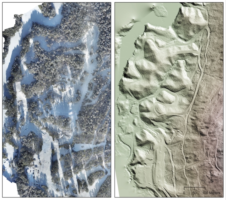
“I was really happy that we were able to help Athletics with this mapping project,” says Casana, who piloted the two drone flights required to map Oak Hill’s elevation. “We do these kinds of surveys for archaeology all the time, logging lots of miles on the drone the past year but this one was especially fun to work on.”
The way lidar, or light detection and ranging, works, is that light pings the Earth’s surface with a laser from a sensor. How long it takes for that light to bounce off whatever it hits and return is used to determine the distance.
“It’s good for mapping topography even under trees,” says Casana. “Some of the pulses will see all the way down to the ground, providing a reflection off the ground while others will just be reflections off the leaves or branches.”
A huge dataset, known as a “point cloud,” is then generated.
The 3.3-kilometer loop features the highest elevation of the homologated trails at 148 meters, or 485.6 feet, with a 47-meter descent to the low point of 101 meters. The total climb around the loop is 114 meters, with a maximum climb of 35 meters.
“We took the millions of points obtained at Oak Hill and then turned it into an average surface elevation,” says Ferwerda. “Our raw data showed the trees, the ski jump, and the telephone wires at the site, so once we filter that out, you end up with just the topography of the ground—the bare earth model—and can map the elevation and slope.”
In addition, Chipman was able to use data from the local site as an example in his Environmental Applications of GIS class this winter when discussing lidar data for 3D mapping and visualization. Next term, he will be developing a new classroom activity for students in future GIS courses, involving the use of lidar point clouds from different sources to analyze changes in the land surface and vegetation cover.
“We’re so grateful to Callie and the rest of Dartmouth team for preparing what was needed for course certification, as being able to offer elevation course data is a tremendous asset for racers and recreation skiers alike, who want to check out the courses before they visit,” says Peter Milliken, chair of the nonprofit organization Friends of Oak Hill, and co-founder of Tuckerman Capital.
“For nearly a decade, we’ve been partners with Dartmouth. We want to make Oak Hill a place that’s accessible to skiers of all types, so we’re also trying to lower the entry barriers for new skiers,” says Milliken.
Through 2026, passes and rental equipment are free to all Dartmouth students due to the generous support of a Dartmouth alumnus and two Upper Valley community members.
As part of a two-year renovation project underway at Oak Hill, upgrades planned for the summer include the construction of a shed for grooming equipment, warming hut, and new parking lot, and installation of new lighting and a solar field to offset energy usage from snowmaking and lighting. The solar project is also due to a gift from a Dartmouth donor.
“Being able to host Winter Carnival at home this year, with great conditions, and not worry about if the snow was going to hang on, was incredible,” says Young. “Our athletes were on cloud nine being able to race at home with the support of their friends, family, and community members that came out to Oak Hill to cheer them on.”
“Winter Carnival is always a special weekend for our team, but being able to welcome the rest of the league to Oak Hill this year brought it to the next level,” says Young.
And, in fact, Oak Hill was still hosting races on Wednesday, March 6, after the New Hampshire Interscholastic Athletic Association moved its high school championships there due to a lack of snow at the original venue.
A comprehensive mapping and signage project is also in the works for the future by Dartmouth and Friends of Oak Hill. The center’s trail network is utilized year-round as it is also used for mountain biking and hiking.